SocioFires
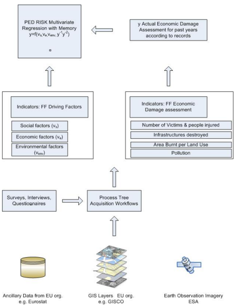
Created a socio-economic toolbox and mathematical model to evaluate forest fire prevention vs. recovery. Developed EU-wide guidelines, risk indicators, and facilitated global knowledge exchange on forest fire resilience.
Created a socio-economic toolbox and mathematical model to evaluate forest fire prevention vs. recovery. Developed EU-wide guidelines, risk indicators, and facilitated global knowledge exchange on forest fire resilience.

Designed an edge-computing, IoT-powered ecosystem for sustainable agriculture. EPSILON contributed to system architecture, and integration of ADSS for edge-based farming intelligence.
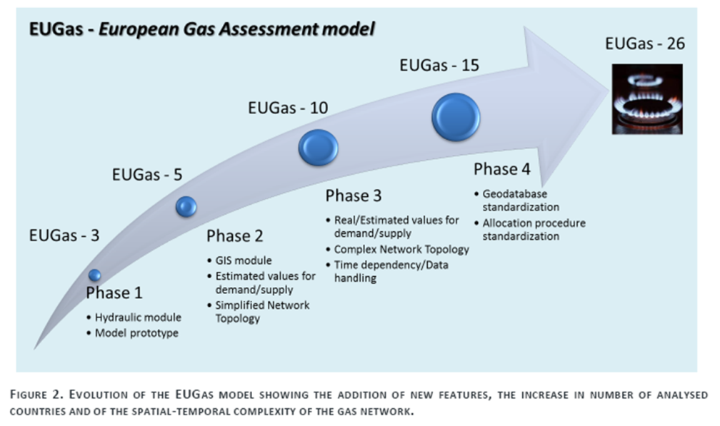
The project extended the EUGas model to 10 EU countries, integrating national gas transmission systems in a GIS environment to assess infrastructure resilience under geopolitical and technical stress scenarios.
The project supported the National River Basin Monitoring Network (NMN) in Greece, including data quality control, database development, annual reporting, and revision of monitoring stations in line with WFD.

Smart city digital twin ecosystem for disaster resilience. Integrated Copernicus, UAVs, and AI for early warning, real-time risk monitoring, and emergency simulation with cross-border collaboration features.
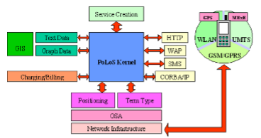
The main objective of the IST/POLOS project is the design and implementation of an integrated Platform for Location-Based services, covering the latest technological achievements in the sector of Geographical Information Systems, positioning techniques and network interfaces, in order to de-sign and implement a platform capable of providing full functionality aimed to design, create and deploy
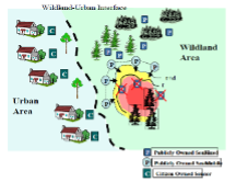
FOMFIS is a computerised system based on ESRI GIS technology, aimed to forecasting and managing forest fires. It consists of the modules: fuelling, ignition, risk mapping, fire propagation and behaviour, and resources allocation to tackle fires.
SCIER is implementing a multi-risk management platform, characterized by an open architecture based on EU standards, which incorporates different models that share common data inputs and deliver standardized outputs that can be visualized and analysed via a GIS user-friendly environment.
The TISA project improves the existing flood forecasting using meteorological, hydrological and water quality data as well as broadcast of warnings.
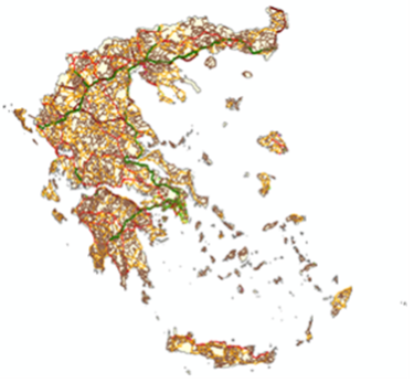
The project included Field survey, road to road research and recording with GPS devices, photo cameras, tablet PCs and map sketches.