

ArcGIS technology to produce three-dimensional Aerodrome Navigational Databases for the General Aviation, and a database with 2000+ 3D-visualized EU aerodromes
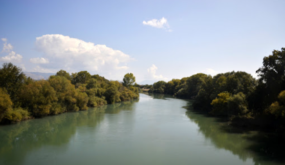
Environmental Impact Assessment for irrigation and drainage works in Zones 11A–11B of Kato Acheloos. Covered pumping systems, agrochemical impact, habitat disruption, and water quality monitoring measures.

Designed an edge-computing, IoT-powered ecosystem for sustainable agriculture. EPSILON contributed to system architecture, and integration of ADSS for edge-based farming intelligence.

A modular and scalable GIS-based platform designed to support the entire life-cycle of forest and wildland fire management. It delivers situational awareness, early warning, crisis simulation, post-disaster impact assessment, and knowledge dissemination tools for Civil Protection and Disaster Risk Management (DRM) authorities. Brochure

Geomatics / GIS methodology for Soil Fuel Classification production and mapping (FCM Webservices) based on INSPIRE principles, supporting the ArcFIRE wildfires platform
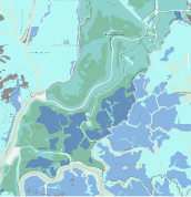
The project creates a fully integrated water system which ties together all parts of the network, including the geographic information system (GIS), water leakage management system, pumping station control systems and the SCADA systems at each service branch. EPSILON is supplying a 5-years training and a 3-year preventative maintenance.
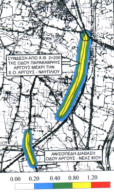
Environmental Impact Assessment for the Argos Bypass termination and flyover to N. Kios road. Evaluated impacts on noise, aesthetics, vegetation, and traffic improvement; proposed slope planting, monitoring, and excavation waste management.
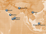
The ASIA_CITY project supplies a platform for the local-regional tourism authorities in Asia aimed to develop-enhance their tourism plans by pre-senting a commonly accepted plan -a Joint Strategy- in the IST technology field of “on-line navigational city information”.

Earth observation technology (Sentinel-4/5) to monitor the atmospheric ozone profile with unprecedented accuracy with multiple applications, incl. UV skin-heath impacts
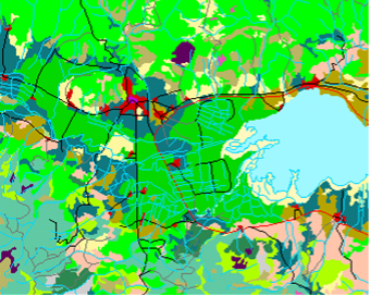
The NPS research project establishes a network of Mediterranean & Black Sea scientific organizations on state-of the-art GIS technologies as remote sensing and mathematical modelling integrated in a GIS database for the control and surveillance of Mediterranean & Black sea coastal water resources and the estimation of NPS pollution impacts.
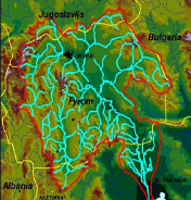
The project is funded by the Hellenic Foreign Office and delivers a sustainability & action plan for the entire river basin and the cataloguing of data and information stored into a publicly available website.

It aims at delivering time-aware extension of data models developed in the context of previous/ongoing EU INSPIRE related projects, application based on the integration of existing databases and services and value added services for spatio-temporal data management, processing, analysis and interactive visualization.
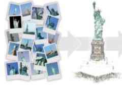
The aim of c-Space is to leverage on people familiarity with Augmented Reality (AR) software for tablets/smart phones and on emerging micro-projection technology to unleash users’ inventiveness.
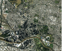
The EPSILON-CICADE joint venture bases its operations on the production of mapping data, from the aerial photographs to the processing and provision of that data.

CITY-WELLNESS proposed the development of a globally scalable, AI-powered Software-as-a-Service (SaaS) platform to support urban decision-makers in implementing zero-pollution strategies. Building upon Horizon 2020 NetZeroCities and EO4EU technologies, the platform integrates environmental monitoring, health risk assessment, and socio-economic indicators into a City Digital Twin (CDT) and a City-Wellness Index (CIWI).
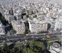
The project delivers the SDI for the region of Argiroupoly and builds GIS enabled s/w applications that support local/regional Stakeholders in their day-to-day activities.
COPESTAT (Copernicus Countries Statistical Services) plans, streamlines, and selective applies a statistical database to Copernicus-Networks, capable to providing and marketing statistical information (east-west, west-east) via information technology infrastructure, electronic media, telematics and GIS.

Copernicus is the European Union’s Earth revolutionary Earth Observation and Monitoring program, which is monitoring our planet and its environment by a set of satellites and taking a continuous “health check” of the Earth.
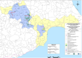
Extension of the main project which has been the integrated master plan of the broader area of Nicosia. It concerns the use of recycled water from sewage treatment plants (STPs) Anthoupoli and Vathia Gonia of the broader area of Nicosia, and STPs in Aradippou.

DEFORM was a key initiative under the Operational Program “ATTICA 2014-2020,” specifically aligned with Priority Axis 01, which aimed to boost research, technological development, and innovation among SMEs in the Attica region. The project sought to enhance research and innovation efforts, particularly in areas like geoinformatics, space services, and safety technologies, with a focus on
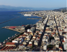
The project delivers the SDI for the region of Patras and builds GIS enabled s/w applications that support local/regional Stakeholders in their day-to-day activities.
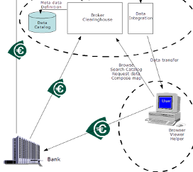
DIGITAL-SEE aims at sharing spatial digital information across South East Europe, in three phases feasibility, technology implementation and pilots commercial operation.

The general aim of the project is the drainage and flood protection in the river basin of Agios Ioannis Theologos located at the Municipality of Papagos.
Conducted EIA for the “Panagia–Makryxwri” section of the E65 motorway through sensitive NATURA 2000 areas. Addressed biodiversity, land use, population distribution, and non-point source pollution in Pindos and Kalabaka regions.
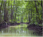
The aim of the project is to promote convergent conservation strategies at landscape scale for coastal habitats of Community significance.
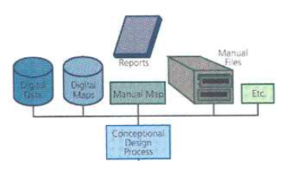
EGIS (Pan-European Environmental GIS) presents an approach to handling environmental GIS information with mapping and networking as an effective concerted planning tool for sustainability and environmental protection.
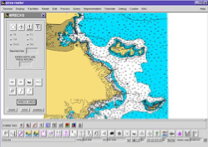
In partnership to LaserScan Ltd, UK, EPSILON produced for a private client and the Hellenic navy a demonstrator. The set of electronic navigation charts followed the ECDIS/S57 standards.
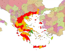
The project aimed to develop a theory and a mathematical model platform combined with a tool to assist decision makers to estimate sustainability of regions and generate and cluster environmental sustainability indicators (ESIs) for EU-NUTS-II and NUTS-III regions.
Developed an emergency management system for oil spill monitoring using satellite remote sensing and GIS. Included image analysis, simulation models, database tools, and decision support for public authorities across the Mediterranean.
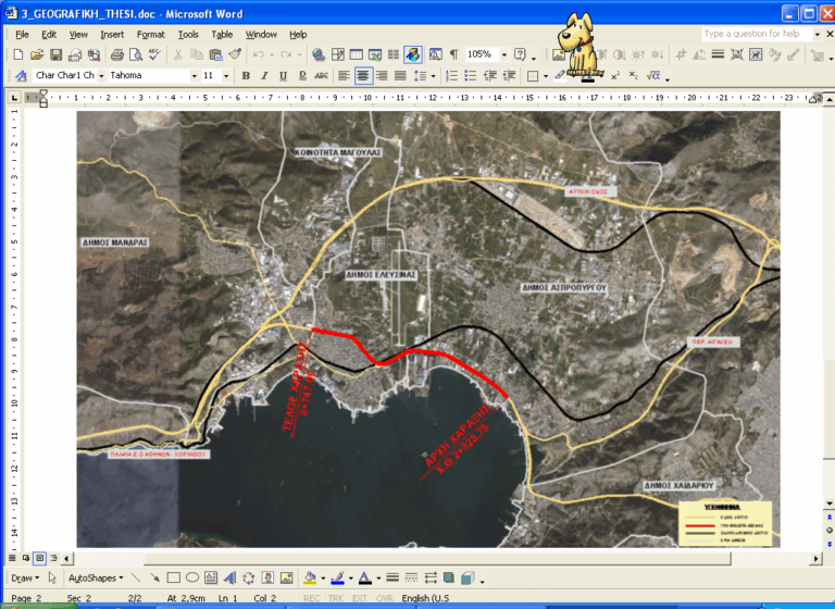
EIA for the conversion of the Athens–Korinthos National Road (Dafni–Elefsina) into a highway. Scope included eco-data acquisition, physical and biological analysis, impact modeling, and legislative compliance for environmental permitting.
Created EO-based mapping services for the retail sector under ESA funding. Delivered geospatial analytics integrated with marketing software, validated through field surveys and statistical comparison, and promoted at industry events.
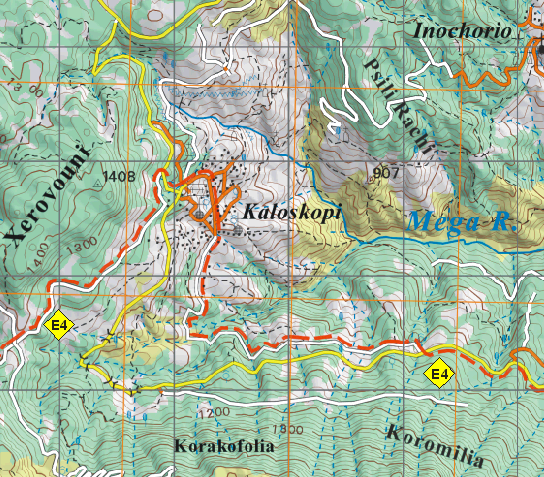
Produced 24 high-resolution mountaineering maps at 1:50,000 scale using GPS and satellite data for GNTO. Developed digital cartographic database and multilingual outputs for trails across major Greek mountains.
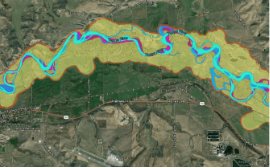
The project aimed at an integrated river management dealing with hydrologic and environmental engineering studies related to the storm drainage of the National Railway of Greece.
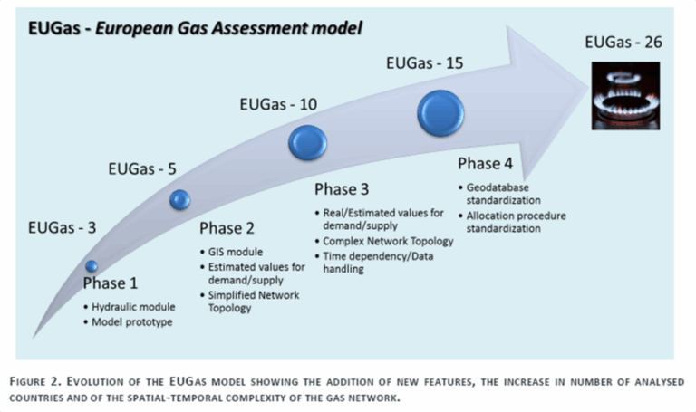
The project extended the EUGas model to 10 EU countries, integrating national gas transmission systems in a GIS environment to assess infrastructure resilience under geopolitical and technical stress scenarios.
Used satellite radar interferometry (MTInSAR) to detect ground deformation in Attica. Produced vulnerability maps, conducted feasibility studies, built stakeholder capacity, and supported EO-based land-use planning and safety management.
An integrated GIS and remote sensing platform for flood risk monitoring across the Mediterranean and Black Sea basins. Provided modeling tools, land use mapping, water quality parameterization, and training workshops in 6 countries.
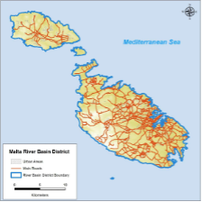
The overall objective of the contract is the preliminary assessment of the Malta River Basin District for the identification of catchments with a potential significant flood risk, including the development of a national scale predictive model.
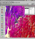
FOMFIS is a computerised system based on ESRI GIS technology, aimed to forecasting and managing forest fires. It consists of the modules: fuelling, ignition, risk mapping, fire propagation and behaviour, and resources allocation to tackle fires.

Proposed to support border surveillance using Copernicus SAR data to detect high-speed “go-fast” smuggling boats. Combined Sentinel-1 data analysis, ship wake detection, and AIS fusion for activity pattern analysis in Mediterranean sea corridors.
Designed Greece’s National Geology GIS System with 40 thematic layers across 30 regions. Produced digital and print geological products, reinforced IGME’s research capabilities, and developed a commercial data distribution platform.
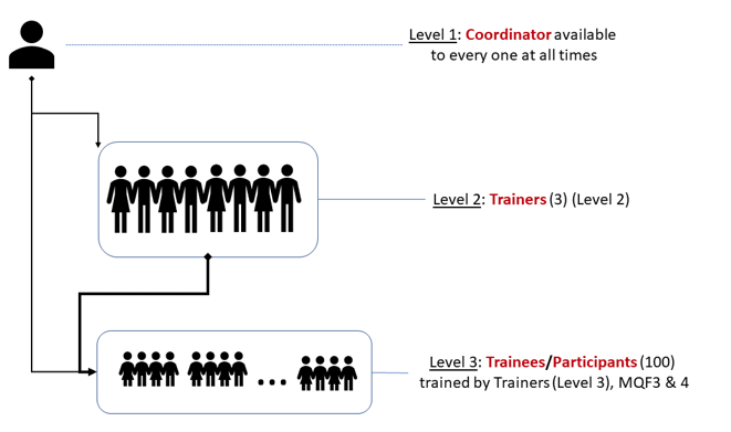
Proposed to train 140 public servants in Malta on GIS and remote sensing. Delivered modular courses (basic and advanced), skill assessments, and digital resources to improve spatial planning capacity and compliance with EU data directives (e.g. INSPIRE, Aarhus).

GeoSmartCity contributes to the Smart City implementation by establishing a cross-platform, re-usable and open hub able to publish open geographic information and to provide specialized services based on open standards.
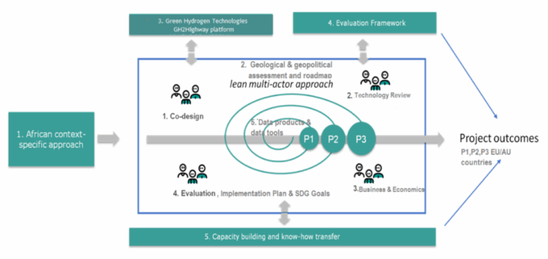
Proposed to establish a Europe–Africa green hydrogen corridor, delivering geological storage analysis, infrastructure simulation, and hydrogen ecosystem modeling. Aimed to strengthen EU energy resilience and support African development through sustainable H₂ supply chains.
Multi-Risk platform based on risk models for 9 hazards: earthquake, wildfire, landslide, ground movement, volcano, tsunami, extreme weather, flood, industrial accident.
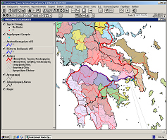
Developed the national GIS-based postal delivery system for the Hellenic Post (ERMIS). Included route optimization using RouteSmart, daily GPS updates, and integration of telecom systems for real-time dispatching.

New Generation of a recoverable low-cost micro-UAV platform for wildfires, structurally robust to fly through the fire and acquire/forward real-time info for fire management

Proposed to deliver a modular geo-referenced cloud platform (HPlus) for climate risk analysis, remediation, and lifecycle-based decision-making on cultural heritage sites. Included visualization tools, pilot sites, conservation guidelines, and an EEIG for long-term platform operation.
Proposed to deliver a modular geo-referenced cloud platform (HPlus) for climate risk analysis, remediation, and lifecycle-based decision-making on cultural heritage sites. Included visualization tools, pilot sites, conservation guidelines, and an EEIG for long-term platform operation.

Hub for indoor open geomatics data regarding public spaces and hospitals, integrating middleware for indoor/outdoor tracking and management of people and assets.
Open 3D-platform for three smart city services: routing,, renewable energy, real-time noise mapping, interfaced into the City Operations via webservices.

Technology support services to the MITA (Malta Information Technology Agency) related to the implementation of the EC INSPIRE directive, across multiple sectors
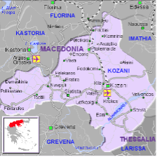
The project delivers the SDI for the region of Kozani and builds GIS enabled s/w applications that support local/regional Stakeholders in their day-to-day activities.
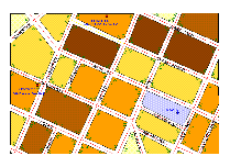
The object was the creation and maintenance of topographic uniform background for the area of Municipality of Galatsi and the update of all the approved town planning schemes, modifications, technical implementation reports street plan, the elevation studies, building terms, the statutory purposes and the values of the area.
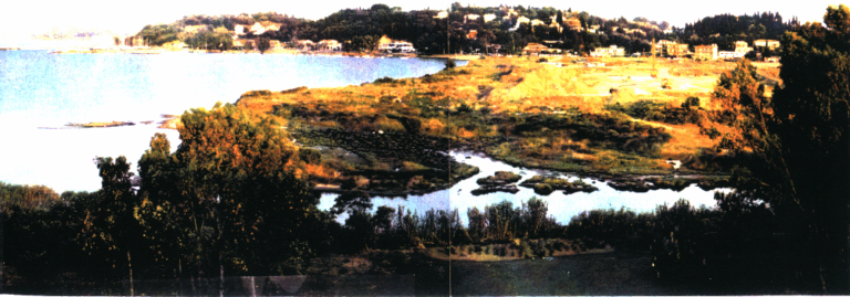
Developed a management plan for the Bouka wetland near Potamos River in Kerkyra, including artificial wetland design, area rehabilitation, and protection measures for construction near the sewage treatment plant.
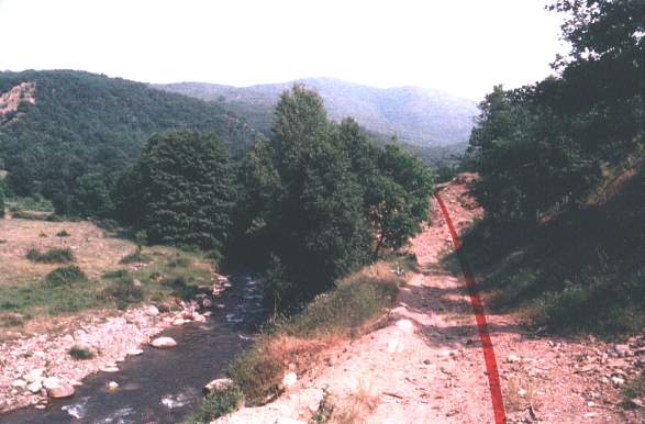
Improvement of the Kastoria–Florina national road, bypassing Kastoria and enhancing transport to Krystallopigi and Prespes. EIA included mitigation of noise, erosion, habitat loss near Aliakmonas River, and proposed measures for landscape and ecological protection.
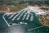
Environmental Impact Assessment for the construction and operation of Lavrio Port’s recreational marina zones (Marines A and B). Included eco-data collection, spatial analysis, modelling, and stakeholder consultation on mitigation planning.
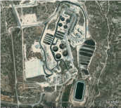
Feasibility study for the reuse of recycled water from Limassol’s treatment plants. Assessed storage and discharge alternatives, developed hydraulic models, and recommended cost-effective reuse scenarios such as aquifer recharge and irrigation.
Proposed to establish a large-scale biodiversity observation and simulation framework across EU sea basins. Included sensor networks, spatial prioritization for conservation, data integration from EO platforms, and modeling of biodiversity shifts due to human and climate pressures.
Proposed to establish a large-scale biodiversity observation and simulation framework across EU sea basins. Included sensor networks, spatial prioritization for conservation, data integration from EO platforms, and modeling of biodiversity shifts due to human and climate pressures.
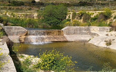
GIS database for 71 Dams and 75 Reservoir sites, to accommodate dams/reservoirs technology inspection, water - agricultural usage, rehabilitation regulatory policy
The purpose of the project is to evaluate the risk from known threats and hazards that have the potential to significantly impact Malta’s security.
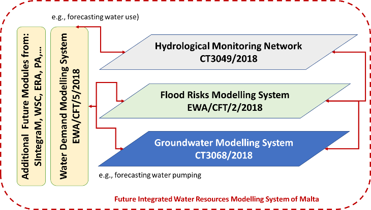
Proposed to develop GIS-integrated groundwater flow models supporting Malta’s 2nd River Basin Management Plan. Covered variable-density simulations, ArcGIS integration, data gap analysis, and training of EWA staff for sustainable aquifer resource planning.

Implemented integrated coastal ecosystem management on Salamina Island through water quality monitoring, pollution modelling, and satellite analysis. Pilots addressed waste management, coastal restoration, and marine habitat protection under MEDSPA funding.
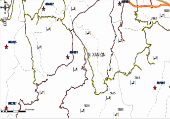
“National Register of Roads”, is defined as the integrated database of geographical and descriptive data that supports the rational structuring and organizing the management of road network data in the country and will create the platform of an Integrated Geographic Information System for managing road network and road environment in the country.
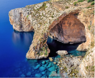
The project delivers management plans & legislative frameworks for all 34 terrestrial NATUA 2000 sites for the Maltese Islands.
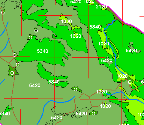
Mapping and classification of flora habitats in 68 NATURA 2000 sites across Peloponnese and Western Greece. Included GIS-based field data integration, rare species mapping, and land cover digitization with final maps at 1:20,000 and 1:50,000 scales.
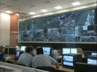
This multi-million project was initiated in 2003 and aimed at the covering of the security of the entire sector of the Olympics Games ATHENS2004. It involved real time security monitoring and actions for athletes, population, VIPS, city security, administration security, visitor’s security, international organizations security and numerous other sectors

Smart city digital twin ecosystem for disaster resilience. Integrated Copernicus, UAVs, and AI for early warning, real-time risk monitoring, and emergency simulation with cross-border collaboration features.
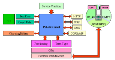
The main objective of the IST/POLOS project is the design and implementation of an integrated Platform for Location-Based services, covering the latest technological achievements in the sector of Geographical Information Systems, positioning techniques and network interfaces, in order to de-sign and implement a platform capable of providing full functionality aimed to design, create and deploy
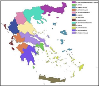
Delivered Greece’s revised National Waste Management Plan (NWMP) aligned with EU Directive 2008/98/EC. Included 18 sectoral waste plans, geospatial mapping, cost-benefit analysis, financing strategies, and a regulatory framework supporting circular economy goals.
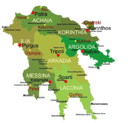
River Basin Management Rehabilitation Damage Studies of fire-ravaged areas of the Peloponnese Region
The project examines the application of different hydraulic scenarios for the flood forecasting and water management for the watersheds of the areas Filia, Charadros, Dessylas, Siamos, Xerillas in the Region of Peloponnese.
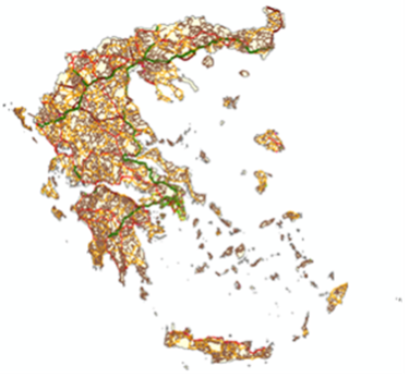
The project included Field survey, road to road research and recording with GPS devices, photo cameras, tablet PCs and map sketches.
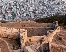
The project creates a fully integrated water system which ties together all parts of the network, including the geographic information system (GIS), water leakage management system, pumping station control systems and the SCADA systems at each service branch.
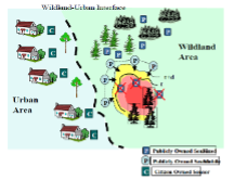
SCIER is implementing a multi-risk management platform, characterized by an open architecture based on EU standards, which incorporates different models that share common data inputs and deliver standardized outputs that can be visualized and analysed via a GIS user-friendly environment.

Proposed to develop an open-access web platform for maritime safety, modeled after SKYbrary (aviation). Included human performance modeling, risk-based operational design, incident databases, training optimization tools, and modular safety innovation toolkits.
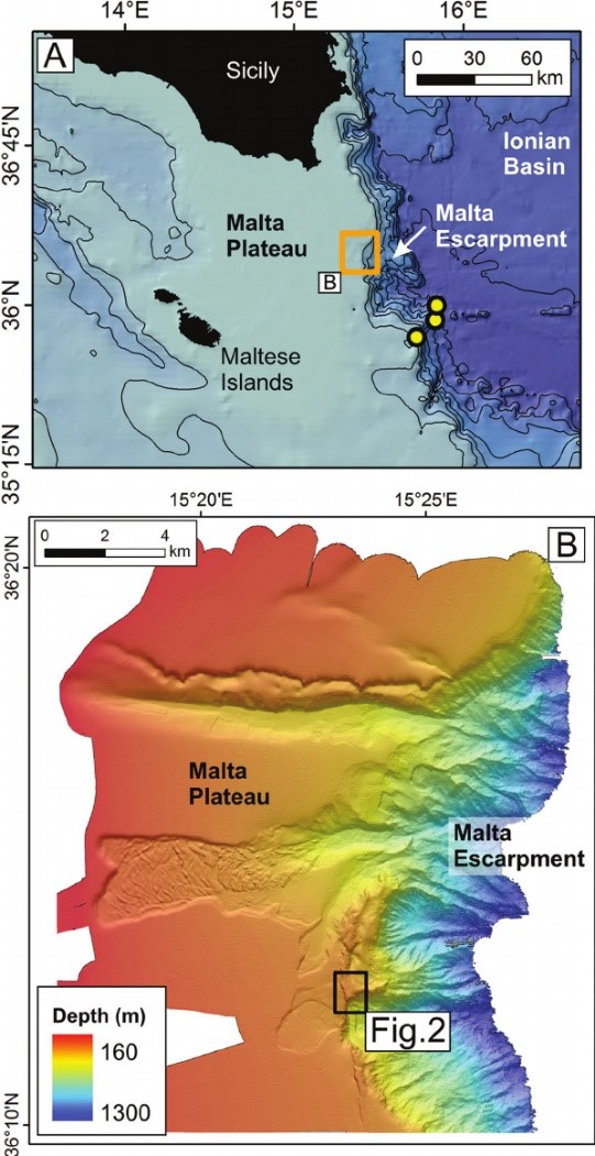
Proposed to deliver high-resolution multibeam mapping and bottom characterization in five marine zones around Malta. Included sediment sampling, geophysical interpretation, and digital seafloor maps to support national marine spatial planning and conservation actions.

Implemented Malta’s Shared Environmental Information System aligned with INSPIRE and EEA protocols. Developed SDI infrastructure, Geoportal tools, and interoperable databases for air, water, land, and noise data.
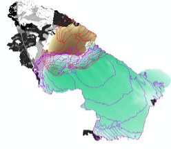
Integrated wild-fire forestry emergency management / monitoring system for the Sex-Sou Forest, N. Greece, based on 16 pilar sensors/cameras, image recognition etc. tech.
EIA for expanding and modifying Serres landfill operations. Evaluated slope stability, capacity optimization, biogas and leachate management, and flood protection, ensuring regulatory compliance under the Waste Framework Directive.
NEXUS modeling platform addressing complexities of interconnection between Land, Food, Energy, Water and Climate via thematic simulation themes and Dashboard tech.
Creation of a cohesive spatial data infrastructure (SDI) for all Maltese entities, ensuring standardized interoperability of 70+ interconnected Geomatics systems
Proposed to create a unified spatial data infrastructure across over 40 Maltese government entities. Delivered an ArcGIS-based interoperable portal, enhanced policymaking through geospatial integration, and provided user training for public sector administrators.
Proposed to implement a national-level training program in GIS and remote sensing for 140 public servants across Maltese agencies. Included modular certification (MQF 4.1 and 5.1), practical skills, and evidence-based planning support for Malta’s land administration and spatial governance.

Supporting Action to turn the challenges of the INSPIRE implementation into business opportunities for the Geo-ICT European SMEs, with an EU-wide completion.
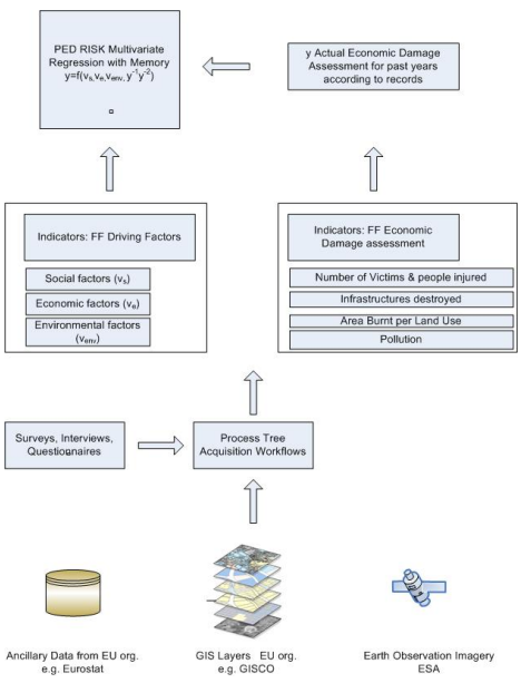
Created a socio-economic toolbox and mathematical model to evaluate forest fire prevention vs. recovery. Developed EU-wide guidelines, risk indicators, and facilitated global knowledge exchange on forest fire resilience.

This is a project involving the coordination of Stakeholders at regional level plus developing the capacities for the INSPIRE Directive implementation in the Southern Europe (Central Greece).
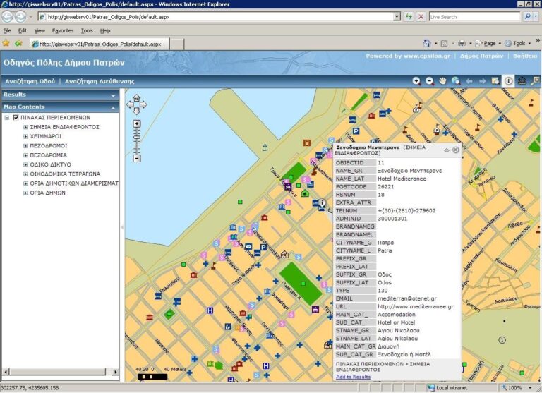
Developed and deployed the Spatial Data Infrastructure (SDI) for the Patras region, aligning with INSPIRE and OGC standards. Delivered GIS tools, public web services (WMS/WFS), stakeholder training, awareness booths, and long-term capacity building for urban planning and land administration.

Delivered accredited GIS and geomatics training to public servants in Malta. Developed L4 and L5 programmes, hands-on courses, and technology-enhanced learning tools aligned with national workforce needs.
Based on cost-sharing development contracts signed with both, the European Commission and Government of Greece, EPSILON has produced the statistical database for the country, which has been linked to the NUTS-X geographic system of the country and the Eurostat development sectors of a country.

Delivered smart services for energy-efficient urban management. Developed tools for building energy assessment, public lighting optimization, and heating control using weather forecasts and GIS data, with pilots across European cities.
The overall objective of the project was the design and development of a Geographic Information System for the prevention and monitoring of natural disasters that derived from forest fires at the university forest Taxiarchis – Vrastamon as well as a zone of one kilometre around the forest.
Created an online GIS-based urban navigation toolkit providing environmental and infrastructure information. Deployed in Antwerp, Munich, and Athens, offering maps, pollution data, and routing info via browsers and Info Kiosks.
The European Union Delegation to the Philippines plans to organize a one-day (full-fay) national conference in Manila targeting a wide range of stakeholders. The aim of the event is to present the Copernicus programme, highlight its governance structure, functionality aspects, nature, methods and availability of data and services, and to illustrate multiple areas of application
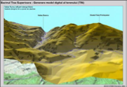
The TISA project improves the existing flood forecasting using meteorological, hydrological and water quality data as well as broadcast of warnings.
The project supported the National River Basin Monitoring Network (NMN) in Greece, including data quality control, database development, annual reporting, and revision of monitoring stations in line with WFD.
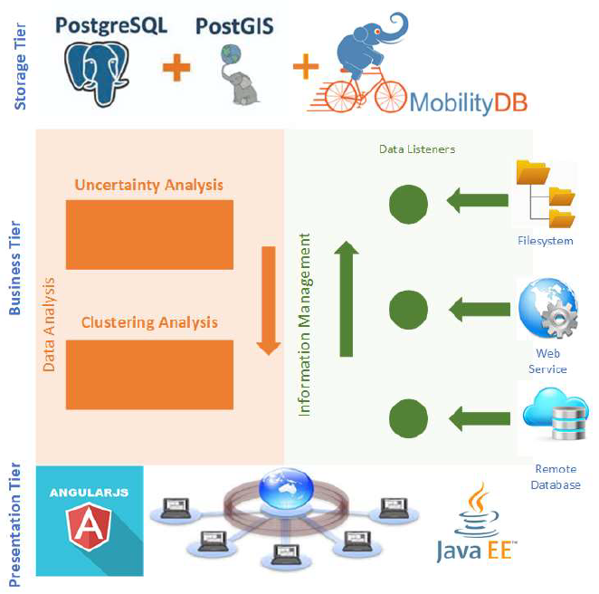
Proposed to build a PostgreSQL/PostGIS-based platform for mapping and analyzing vessel density in European waters. Aimed to support EU Green Deal objectives via digital density maps, marine data integration, and a user-friendly web GIS interface with open-source tools.
Remote sensing (ESA/Copernicus) technology delivering sustainable solutions to overcome broomrape plant parasitism in Mediterranean agricultural systems.