Geomatics

SINTEGRAM

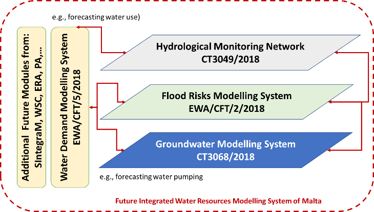
Proposed to create a unified spatial data infrastructure across over 40 Maltese government entities. Delivered an ArcGIS-based interoperable portal, enhanced policymaking through geospatial integration, and provided user training for public sector administrators.
SINTEGRAM Read More »

LOBSTER

Proposed to establish a large-scale biodiversity observation and simulation framework across EU sea basins. Included sensor networks, spatial prioritization for conservation, data integration from EO platforms, and modeling of biodiversity shifts due to human and climate pressures.

LOBSTER Read More »

City Wellness

CITY-WELLNESS proposed the development of a globally scalable, AI-powered Software-as-a-Service (SaaS) platform to support urban decision-makers in implementing zero-pollution strategies. Building upon Horizon 2020 NetZeroCities and EO4EU technologies, the platform integrates environmental monitoring, health risk assessment, and socio-economic indicators into a City Digital Twin (CDT) and a City-Wellness Index (CIWI).

City Wellness Read More »

DEFORM

DEFORM was a key initiative under the Operational Program “ATTICA 2014-2020,” specifically aligned with Priority Axis 01, which aimed to boost research, technological development, and innovation among SMEs in the Attica region. The project sought to enhance research and innovation efforts, particularly in areas like geoinformatics, space services, and safety technologies, with a focus on

DEFORM Read More »

ArcFIRE

A modular and scalable GIS-based platform designed to support the entire life-cycle of forest and wildland fire management. It delivers situational awareness, early warning, crisis simulation, post-disaster impact assessment, and knowledge dissemination tools for Civil Protection and Disaster Risk Management (DRM) authorities. Brochure

ArcFIRE Read More »