ACHERONTAS
The main objective of ACHERONTAS project was the Environmental Impact Assessment for the Agricultural Development of the Acherontas Region.
The main objective of ACHERONTAS project was the Environmental Impact Assessment for the Agricultural Development of the Acherontas Region.
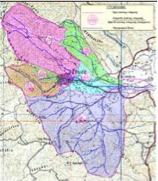
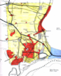
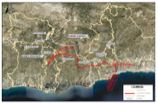
The project delivered applications of hydraulic scenarios for flood forecasting and water management for the watersheds (areas) megalo monastiri, mirko peribolaki, velestino, and skopelos in the Region of Thessalia, Fourka, sikia in the Region of Macedonia, and Thasos.
River Basin Management Of watersheds Read More »
The objective was the preparation of the Strategic Environmental Impact Assessment (SEA) in accordance with the requirements of part b of paragraph 2 of Article 12 Sec. B of Law 3986/2011, to submit the dossier for ESHADA approval, in the preliminary environmental documentation of key development proposals and institutional nature to propose measures that will
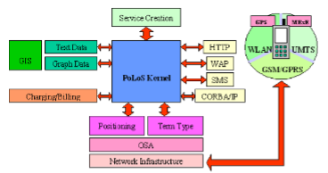
The main objective of the IST/POLOS project is the design and implementation of an integrated Platform for Location-Based services, covering the latest technological achievements in the sector of Geographical Information Systems, positioning techniques and network interfaces, in order to de-sign and implement a platform capable of providing full functionality aimed to design, create and deploy
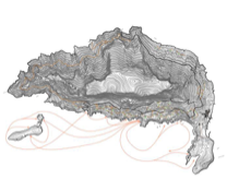
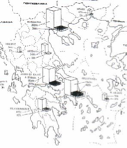
The aim of the study has been the investigation of the environmental impacts of the exploitation of the geothermal reservoir in N. Kessani and introduction of mitigation measures, for a major development plan considering energy production, use of thermal water for greenhouse operations and use of water for thermal surface water enrichments for industrial purposes
The project involved collection and analysis of data, obtained from the public and private sectors, on toxic and hazardous waste, in entire Greece.
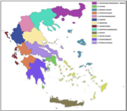
The project delivered the SEA for the new waste management plans & legislative frameworks for Greece.
The project examined the application of different hydraulic scenarios for the flood forecasting and water management for the watersheds of the areas Filia, Charadros, Dessylas, Siamos, Xerillas in the Region of Peloponnese.
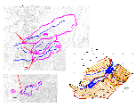
The main objective of these studies was the localization and evaluation of potential environmental impacts incurred from the construction and operation of the Road Viannos – Ierapetra of the south road network of Crete and the proposal of appropriate mitigation measures and monitoring plan.
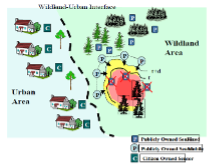
SCIER is implementing a multi-risk management platform, characterized by an open architecture based on EU standards, which incorporates different models that share common data inputs and deliver standardized outputs that can be visualized and analysed via a GIS user-friendly environment.