Aviation

SINTRAIN

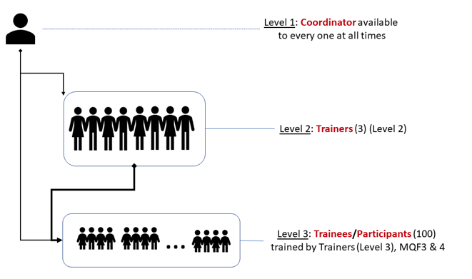
Proposed to implement a national-level training program in GIS and remote sensing for 140 public servants across Maltese agencies. Included modular certification (MQF 4.1 and 5.1), practical skills, and evidence-based planning support for Malta’s land administration and spatial governance.

SINTRAIN Read More »

SINTEGRAM

Proposed to create a unified spatial data infrastructure across over 40 Maltese government entities. Delivered an ArcGIS-based interoperable portal, enhanced policymaking through geospatial integration, and provided user training for public sector administrators.

SINTEGRAM Read More »

LANDING 

LANDING delivers a low-cost software product (SW) assisting pilots of small-medium aircrafts to safely land on a small and poorly equipped fields, under bad-weather and low-visibility conditions.

LANDING  Read More »

C-Space

The aim of c-Space is to leverage on people familiarity with Augmented Reality (AR) software for tablets/smart phones and on emerging micro-projection technology to unleash users.

C-Space Read More »