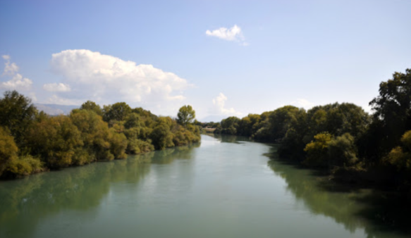
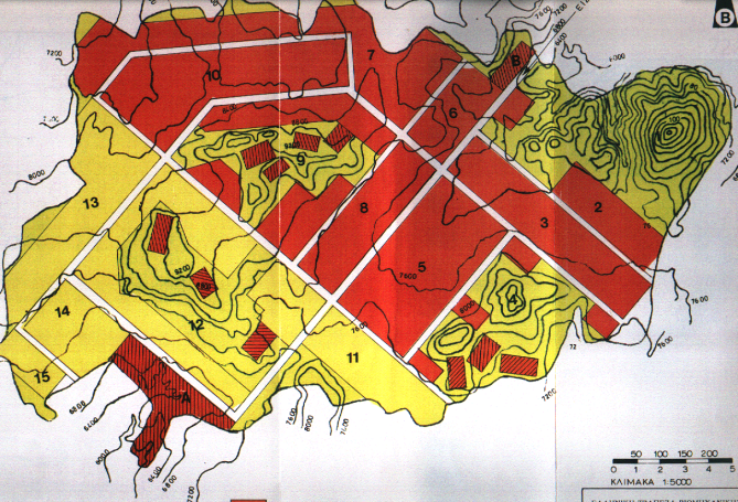
Environmental Impact Assessment for irrigation and drainage works in Zones 11A–11B of Kato Acheloos. Covered pumping systems, agrochemical impact, habitat disruption, and water quality monitoring measures.
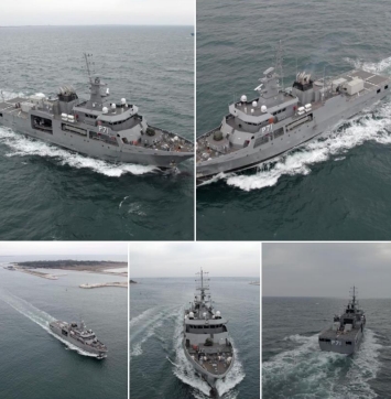
Epsilon Malta Ltd assists the AFM Project Team to prepare the tender documentation for the procurement of the new offshore patrol vessel.

Designed an edge-computing, IoT-powered ecosystem for sustainable agriculture. EPSILON contributed to system architecture, and integration of ADSS for edge-based farming intelligence.
Developed UAV and satellite-based tools to manage herbicide-resistant weeds in rice farming. EPSILON delivered GIS mapping, cloud platform integration, and predictive risk algorithms.
A modular and scalable GIS-based platform designed to support the entire life-cycle of forest and wildland fire management. It delivers situational awareness, early warning, crisis simulation, post-disaster impact assessment, and knowledge dissemination tools for Civil Protection and Disaster Risk Management (DRM) authorities. Brochure
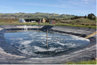
The project provides an innovative detailed engineering design for a waste treatment process & disposal, related to a small and typical wine producing industry, targeted to meet the “zero-emissions” principle.
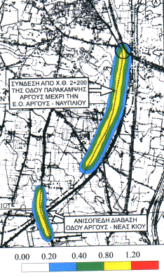
Environmental Impact Assessment for the Argos Bypass termination and flyover to N. Kios road. Evaluated impacts on noise, aesthetics, vegetation, and traffic improvement; proposed slope planting, monitoring, and excavation waste management.
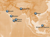
The ASIA_CITY project supplies a platform for the local-regional tourism authorities in Asia aimed to develop-enhance their tourism plans by pre-senting a commonly accepted plan -a Joint Strategy- in the IST technology field of “on-line navigational city information”.
Proposed to develop and demonstrate an autonomous passenger ferry system for coastal commuting, integrating advanced sensors, infrastructure connectivity, cybersecurity, and real-time monitoring. Included feasibility studies, pilot operations in Germany and Greece, and long-term handover to the Hellenic Navy.
The NPS research project establishes a network of Mediterranean & Black Sea scientific organizations on state-of the-art GIS technologies as remote sensing and mathematical modelling integrated in a GIS database for the control and surveillance of Mediterranean & Black sea coastal water resources and the estimation of NPS pollution impacts.
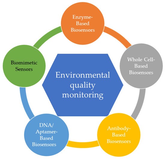
Proposed to design modular biosensors for detecting pollutants in water using advanced materials, RNA-based elements, and fiber-optic or microelectronic systems. Targeted TRL5 with in situ validation, LCA analysis, and integration with EU environmental data platforms under Zero Pollution Action Plan goals.
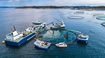
Management technologies and training for the reduction of marine debris from the fisheries and aquaculture value chain in 6 European Mediterranean ecosystems.

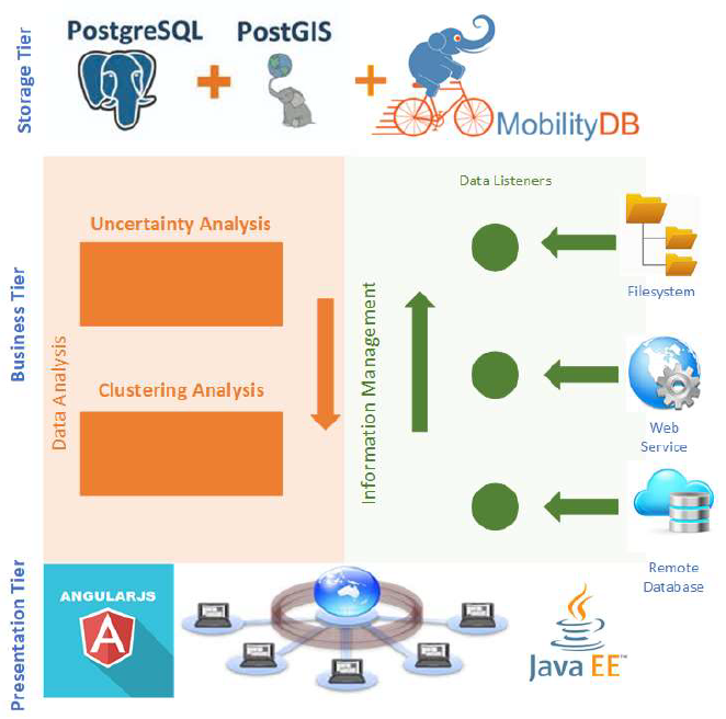
It aims at delivering time-aware extension of data models developed in the context of previous/ongoing EU INSPIRE related projects, application based on the integration of existing databases and services and value added services for spatio-temporal data management, processing, analysis and interactive visualization.
Evaluation of the sustainable exploitation of fish waste for the extraction of bioactive molecules (BAMs) and marine collagen for applications in health, cosmetics, nutraceuticals, and agri-food industries. EPSILON led the socio-economic and environmental impact assessments under WP6 of the project.

CITY-WELLNESS proposed the development of a globally scalable, AI-powered Software-as-a-Service (SaaS) platform to support urban decision-makers in implementing zero-pollution strategies. Building upon Horizon 2020 NetZeroCities and EO4EU technologies, the platform integrates environmental monitoring, health risk assessment, and socio-economic indicators into a City Digital Twin (CDT) and a City-Wellness Index (CIWI).
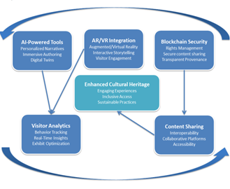
CLIO-Cloud proposed to enhance digital cultural heritage practices across Europe by developing a suite of advanced AI-powered authoring tools, integrated within the European Collaborative Cloud for Cultural Heritage (ECCCH). The project leveraged extended reality (AR/VR), artificial intelligence, blockchain, and real-time visitor analytics to foster immersive, personalized, and sustainable interactions with cultural heritage assets.
The purpose of the project was the preparation of an integrated local sustainable development program, implementing NATURA 2000 and the Habitat Agenda for settlements St, Mathiew and Hlomos of Meliteieon Municipality of Corfu Prefecture.
Designed a cyber-secured decision support toolbox to enhance maritime surveillance capabilities. Developed scenario simulators, multi-layer GIS modules, risk assessment tools, and a foresight technology watch platform.
DEFORM was a key initiative under the Operational Program “ATTICA 2014-2020,” specifically aligned with Priority Axis 01, which aimed to boost research, technological development, and innovation among SMEs in the Attica region. The project sought to enhance research and innovation efforts, particularly in areas like geoinformatics, space services, and safety technologies, with a focus on
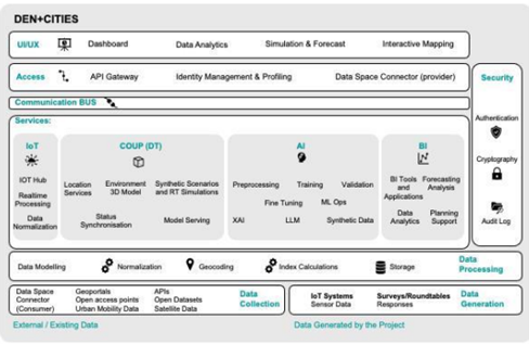
DEN Cities proposed to develop a scalable, people-first model for designing Energy Neutral+ (EN+) districts, aiming to transform urban density into a tool for climate-neutral transitions.
The project delivers the SDI for the region of Patras and builds GIS enabled s/w applications that support local/regional Stakeholders in their day-to-day activities.
Feasibility and environmental studies for the Igoumenitsa–Patra–Pyrgos–Kalamata road axis and Antirio–Agrinio segment. Evaluated alternative alignments based on environmental compatibility, cost, and development potential.
The aim of the project is to promote convergent conservation strategies at landscape scale for coastal habitats of Community significance.
Established an Environmental Economics and Policy Centre in St. Petersburg through EU–Russia academic cooperation. EPSILON led training, curriculum design, EU law transfer, and creation of long-term institutional ties.
The aim of the study has been the investigation of the environmental impacts of the exploitation of the geothermal reservoir in N. Kessani and introduction of mitigation measures, for a major development plan considering energy production, use of thermal water for greenhouse operations and use of water for thermal surface water enrichments for industrial purposes

Proposed to create an intelligent logistics platform using Digital Twins, AI, and blockchain to optimize multimodal supply chains. Targeted zero-emission logistics and synchronized transport operations through real-time simulation and stakeholder integration across European corridors.
Developed an emergency management system for oil spill monitoring using satellite remote sensing and GIS. Included image analysis, simulation models, database tools, and decision support for public authorities across the Mediterranean.
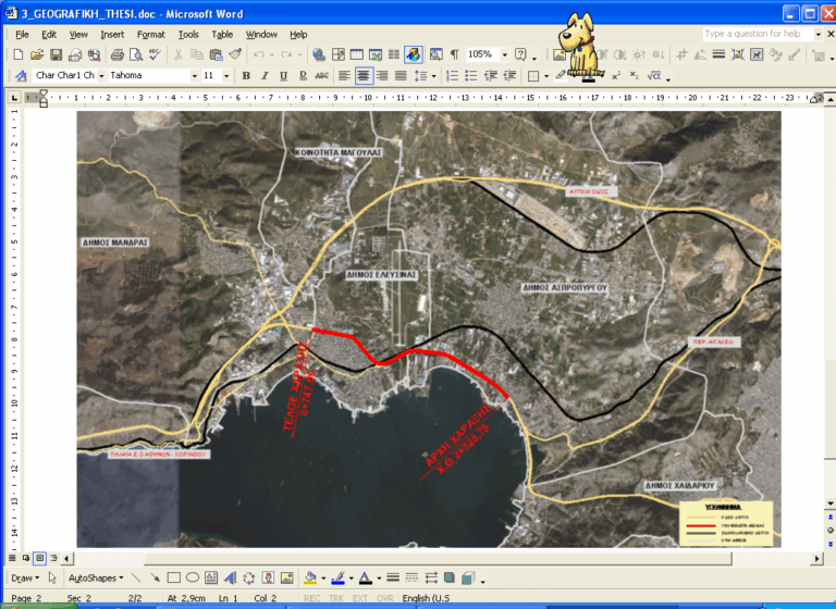
EIA for the conversion of the Athens–Korinthos National Road (Dafni–Elefsina) into a highway. Scope included eco-data acquisition, physical and biological analysis, impact modeling, and legislative compliance for environmental permitting.
Created EO-based mapping services for the retail sector under ESA funding. Delivered geospatial analytics integrated with marketing software, validated through field surveys and statistical comparison, and promoted at industry events.
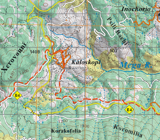
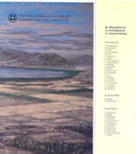
Produced 24 high-resolution mountaineering maps at 1:50,000 scale using GPS and satellite data for GNTO. Developed digital cartographic database and multilingual outputs for trails across major Greek mountains.
The project delivered the SEA for the new waste management plans & legislative frameworks for Greece.
An integrated GIS and remote sensing platform for flood risk monitoring across the Mediterranean and Black Sea basins. Provided modeling tools, land use mapping, water quality parameterization, and training workshops in 6 countries.
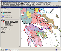
Designed Greece’s National Geology GIS System with 40 thematic layers across 30 regions. Produced digital and print geological products, reinforced IGME’s research capabilities, and developed a commercial data distribution platform.
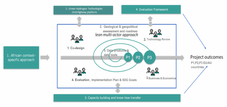
Proposed to establish a Europe–Africa green hydrogen corridor, delivering geological storage analysis, infrastructure simulation, and hydrogen ecosystem modeling. Aimed to strengthen EU energy resilience and support African development through sustainable H₂ supply chains.
Developed the national GIS-based postal delivery system for the Hellenic Post (ERMIS). Included route optimization using RouteSmart, daily GPS updates, and integration of telecom systems for real-time dispatching.

Proposed to deliver a modular geo-referenced cloud platform (HPlus) for climate risk analysis, remediation, and lifecycle-based decision-making on cultural heritage sites. Included visualization tools, pilot sites, conservation guidelines, and an EEIG for long-term platform operation.
Proposed to deliver a modular geo-referenced cloud platform (HPlus) for climate risk analysis, remediation, and lifecycle-based decision-making on cultural heritage sites. Included visualization tools, pilot sites, conservation guidelines, and an EEIG for long-term platform operation.
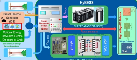
INTEGRATED HYBRID-ENERGY STORAGE SYSTEMS FOR WATERBORNE APPLICATIONS

Developed a VR-based small boat simulator for skipper training. Delivered immersive environments, real-time weather simulations, cloud computing platform, and instructor tools for improving maritime safety through experiential learning.
Open 3D-platform for three smart city services: routing,, renewable energy, real-time noise mapping, interfaced into the City Operations via webservices.

Developed a metagenomics-based platform for detecting allergens and verifying food authenticity in high-value products. Integrated blockchain for secure traceability and supported businesses in on-site sampling and food fraud prevention.
The purpose of the project was the preparation of an integrated local sustainable development program, implementing the Habitat Agendafor settlements St, Mathiew and Clomos of Meliteieon Municipality of Corfu Prefecture, whose philosophy, directions, specific actions and measures respond effectively the needs and problems of the local community while prescribing the prospects for sustainable development.
The project involved the design, development, deployment, and maintenance of an interactive web-based educational platform for the Gharb Local Council, Gozo, under the Interreg V-A Italia-Malta AMPPA project. The goal was to enhance public awareness on marine biodiversity, sustainability, and environmental conservation through gamified digital tools.
Proposed to develop inherently safe, modular battery systems for waterborne transport. Focused on cell-level thermal runaway prevention, predictive maintenance, harmonized certification processes, and system-wide electrification integration across maritime vessels.
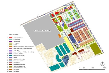
Designed wet utility networks for Jeddah Oasis including potable water, sewerage, irrigation, stormwater, and flood protection systems. Complied with MODON and KSA specifications, covering full schematic to construction design.
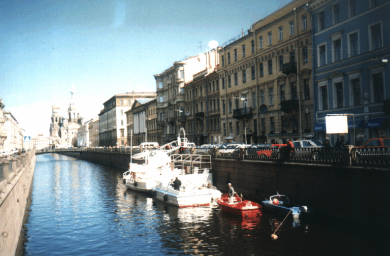
Creation of the “ECOS” Center at St. Petersburg Technical University under the Tempus-Tacis program. Delivered training on environmental economics and developed curricula in agriculture, energy, and transport.
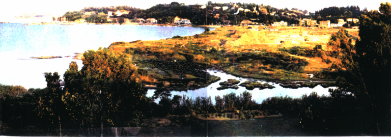
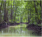
Developed a management plan for the Bouka wetland near Potamos River in Kerkyra, including artificial wetland design, area rehabilitation, and protection measures for construction near the sewage treatment plant.
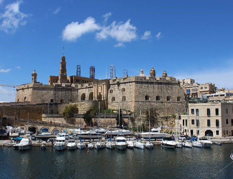
Conducted hazard analysis and emergency planning for Valletta’s cruise terminal. Delivered evacuation protocols, risk scenario modelling, and tabletop exercises for Transport Malta.
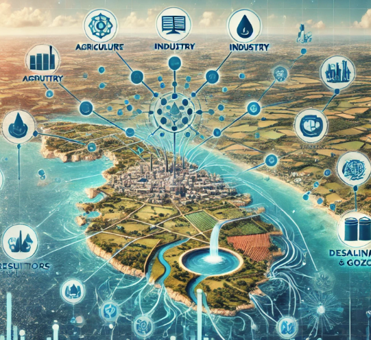
Proposed to assess sectoral water demand in Malta and Gozo under LIFE-IP using econometric modeling. Delivered 50-year forecasts across domestic, agricultural, industrial, and tourism sectors to support integrated planning and ArcGIS-based scenario tools.
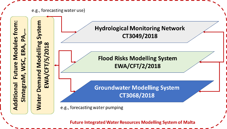
Proposed to develop GIS-integrated groundwater flow models supporting Malta’s 2nd River Basin Management Plan. Covered variable-density simulations, ArcGIS integration, data gap analysis, and training of EWA staff for sustainable aquifer resource planning.
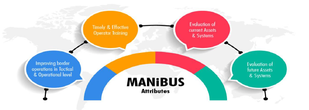
Proposed to design a 4D digital twin system for land and maritime border surveillance. Delivered interoperable platforms, training tools, XR interfaces, decision-support modules, and real-time integration of heterogeneous data for improved EU external security.
Medisolae-3D is an international project funded by the European Commission under the eContentplus program. eContentplus stimulates “the aggregation of existing national datasets into cross border datasets.
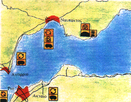
Designed and implemented a pilot solid waste management program in Nafpaktos, Antirrio, Rio, and Aktio. Covered urban recycling, composting, biogas collection, and public awareness campaigns to enhance waste treatment efficiency.

Developed a neurocomputing-powered framework to enhance climate modelling and adaptation strategies. Delivered co-creation tools, digital dialogues, and AI modules to support the EU Adaptation Strategy and climate literacy.
Proposed to establish a Europe-wide network of demonstration farms implementing Integrated Pest Management (IPM). Included stakeholder platforms, training modules, national IPM hubs, policy recommendations, and data sharing via a collaborative digital environment.
Promoted integration of water, energy, and food systems for a circular, low-carbon economy. Engaged 48 partners across Europe in policy harmonization, training, and best practice sharing through a multi-sectoral Nexus framework.
Proposed to develop a hybrid autonomous underwater system combining AUV and glider technologies. Delivered enhanced energy efficiency, secure data transmission, deep-sea mapping capabilities, and operational autonomy with low-cost deployment systems.
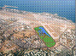
The project concerns the design of the Canoe-Slalom Olympic Center and supporting infrastructures. The up to date stadium design concerns mainly an artificial channel which simulates a river’s natural flow.
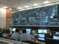
This multi-million project was initiated in 2003 and aimed at the covering of the security of the entire sector of the Olympics Games ATHENS2004. It involved real time security monitoring and actions for athletes, population, VIPS, city security, administration security, visitor’s security, international organizations security and numerous other sectors
TRL9 web platform for life-cycle optimization in shipping. Delivered decision support tools, lifecycle KPIs, and risk-reducing algorithms for vessel design, operation, and end-of-life strategies.

Smart city digital twin ecosystem for disaster resilience. Integrated Copernicus, UAVs, and AI for early warning, real-time risk monitoring, and emergency simulation with cross-border collaboration features.
This project aimed at cataloguing and documenting the basin status of Mikri Prespa (environment, social environment, economic environment, administrative environment. and producing a water and agricultural management plan up to year 2015. The Plan considered two strong components: the environment and the social-economic.
The aim of this project is to provide consultancy services to MITA (Malta Information Technology Agency) related to the implementation of the EC INSPIRE directive.
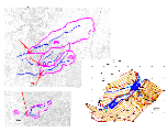
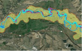
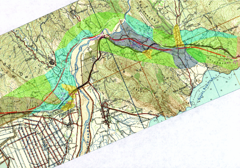
The project examined the application of different hydraulic scenarios for the flood forecasting and water management for the watersheds of the areas Filia, Charadros, Dessylas, Siamos, Xerillas in the Region of Peloponnese.
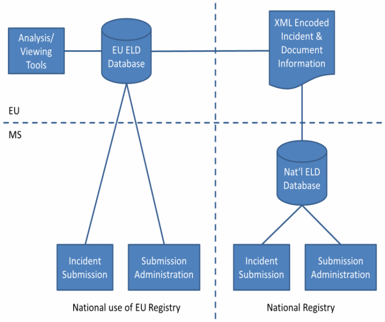
Proposed to support Phase 1 of the REFIT actions for the Environmental Liability Directive. Delivered registry design, legal analysis, harmonized definitions, stakeholder engagement, and capacity-building tools under DG Environment framework contract ENV.D.4.
Delivered Greece’s revised National Waste Management Plan (NWMP) aligned with EU Directive 2008/98/EC. Included 18 sectoral waste plans, geospatial mapping, cost-benefit analysis, financing strategies, and a regulatory framework supporting circular economy goals.
The project delivered applications of hydraulic scenarios for flood forecasting and water management for the watersheds (areas) megalo monastiri, mirko peribolaki, velestino, and skopelos in the Region of Thessalia, Fourka, sikia in the Region of Macedonia, and Thasos.
The project involved the Environmental Impact Assessment for a 97ha industrial zone near Rhodes city, targeting the relocation of industries, mitigation of pollution, and economic development of the prefecture.
The project developed an integrated environmental management plan for Salamina, focusing on coastal protection, pollution modeling, satellite imagery analysis, and pilot actions in waste and nature conservation.
Proposed to develop an open-access web platform for maritime safety, modeled after SKYbrary (aviation). Included human performance modeling, risk-based operational design, incident databases, training optimization tools, and modular safety innovation toolkits.
Implemented Malta’s Shared Environmental Information System aligned with INSPIRE and EEA protocols. Developed SDI infrastructure, Geoportal tools, and interoperable databases for air, water, land, and noise data.
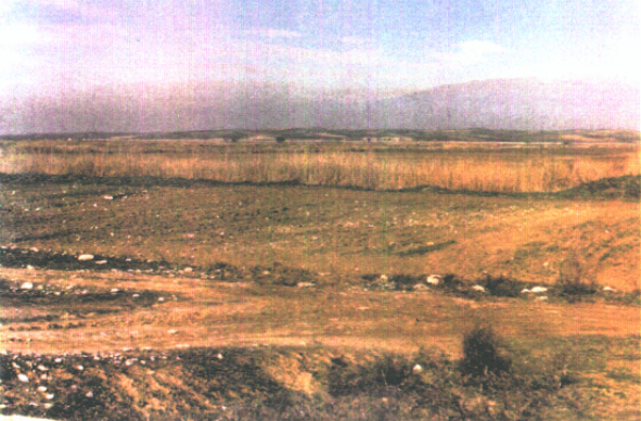
Environmental Impact Assessment for the V Irrigation Project of Serres, spanning 4,500 ha with intakes from Strymonas and Aggitis rivers. Addressed changes to river flow, agricultural runoff, noise, and habitat disturbance, proposing minimum flow and pollution mitigation.
EIA for expanding and modifying Serres landfill operations. Evaluated slope stability, capacity optimization, biogas and leachate management, and flood protection, ensuring regulatory compliance under the Waste Framework Directive.
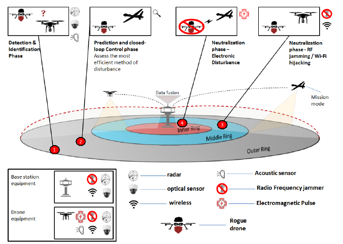
Proposed to deploy a multi-tier cybersecurity and threat-detection platform for protecting water infrastructure using IoT, UAV/USV surveillance, and AI analytics. Covered early-warning, anomaly detection, physical intrusion prevention, and cyberattack countermeasures.
Proposed to deploy a multi-tier cybersecurity and threat-detection platform for protecting water infrastructure using IoT, UAV/USV surveillance, and AI analytics. Covered early-warning, anomaly detection, physical intrusion prevention, and cyberattack countermeasures.
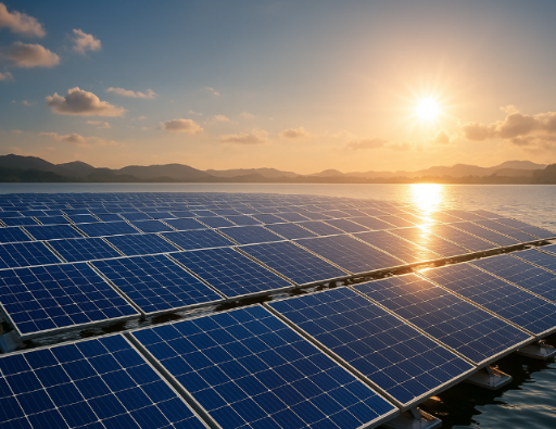
Proposed to design, build, and test a resilient offshore floating solar platform (FPV) for harsh oceanic environments. Delivered TRL6 prototypes, structural testing, circular materials evaluation, and commercialization strategy aligned with EU ocean energy objectives.
This is a project involving the coordination of Stakeholders at regional level plus developing the capacities for the INSPIRE Directive implementation in the Southern Europe (Central Greece).
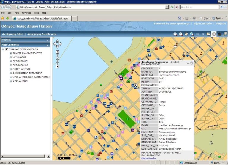
Developed and deployed the Spatial Data Infrastructure (SDI) for the Patras region, aligning with INSPIRE and OGC standards. Delivered GIS tools, public web services (WMS/WFS), stakeholder training, awareness booths, and long-term capacity building for urban planning and land administration.
Delivered accredited GIS and geomatics training to public servants in Malta. Developed L4 and L5 programmes, hands-on courses, and technology-enhanced learning tools aligned with national workforce needs.
The overall objective of the project was the design and development of a Geographic Information System for the prevention and monitoring of natural disasters that derived from forest fires at the university forest Taxiarchis – Vrastamon as well as a zone of one kilometre around the forest.
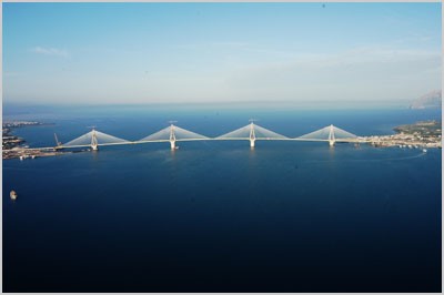
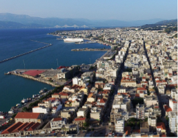
Provided technical support for large-scale infrastructure in Western Greece (Patras Port, Rion-Antirion Bridge). EPSILON delivered real-time consulting, ISO-standard reporting, and coordinated with multiple stakeholders for project oversight.
The objective was the preparation of the Strategic Environmental Impact Assessment (SEA) in accordance with the requirements of part b of paragraph 2 of Article 12 Sec. B of Law 3986/2011, to submit the dossier for ESHADA approval, in the preliminary environmental documentation of key development proposals and institutional nature to propose measures that will
Created an online GIS-based urban navigation toolkit providing environmental and infrastructure information. Deployed in Antwerp, Munich, and Athens, offering maps, pollution data, and routing info via browsers and Info Kiosks.
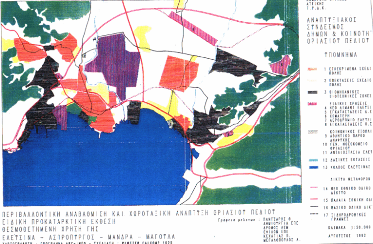
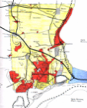
The project aimed to environmentally upgrade Thriassio Pedio through integrated town planning, industrial activity control, and the rehabilitation of degraded areas across Elefsina, Aspropyrgos, Mandra, and Magoula.
The project involved collection and analysis of data, obtained from the public and private sectors, on toxic and hazardous waste, in entire Greece.

Harmonized logistics platform integrating AI and blockchain for real-time planning and event management. Focused on synchro-modal operations, EU-wide demonstrators, and policy recommendations for sustainable logistics.

Promoting climate adaptation acceleration by testing water-focused innovations in European demonstrators. Delivered socio-economic modelling tools, co-created adaptive pathways, and designed replication-ready solutions with impact evaluation.
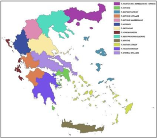
The project supported the National River Basin Monitoring Network (NMN) in Greece, including data quality control, database development, annual reporting, and revision of monitoring stations in line with WFD.
The objectives of this project are to improve the assessment and management of urban risks in the 25 members of the European Union and to arrive at recommendations for a European wide urban risk assessment, and management strategies to ensure better prevention, preparedness and response in the context of an integrated Civil Protection System.
Proposed to build a PostgreSQL/PostGIS-based platform for mapping and analyzing vessel density in European waters. Aimed to support EU Green Deal objectives via digital density maps, marine data integration, and a user-friendly web GIS interface with open-source tools.
Proposed to assess long-term sectoral water demand in Malta under the LIFE-IP initiative. Delivered econometric modeling forecasts for domestic, agricultural, industrial, and tourism sectors, integrated with ArcGIS for planning and scenario analysis over a 50-year horizon.
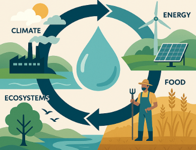
Proposed to operationalize the water–energy–food–ecosystem nexus in EU and regional policies. Delivered the WATNex Suite of tools, stakeholder engagement strategy, and policy integration pathways to support SDGs, climate resilience, and nexus-aligned decision-making.