SALAMINA
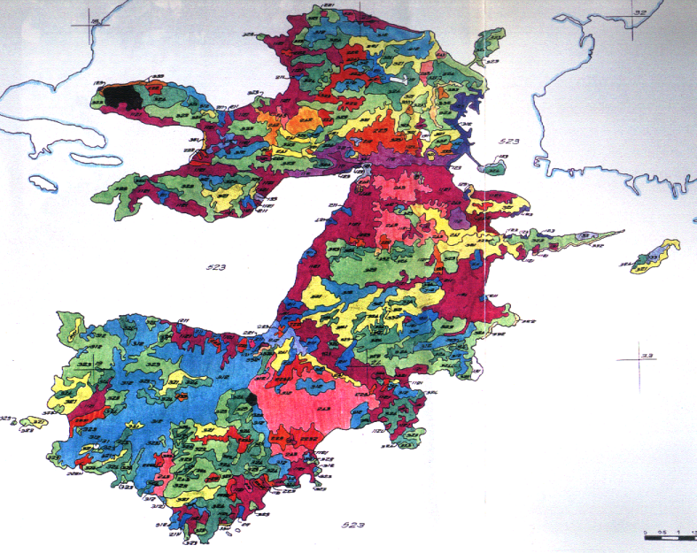
The project developed an integrated environmental management plan for Salamina, focusing on coastal protection, pollution modeling, satellite imagery analysis, and pilot actions in waste and nature conservation.
The project developed an integrated environmental management plan for Salamina, focusing on coastal protection, pollution modeling, satellite imagery analysis, and pilot actions in waste and nature conservation.
Environmental Impact Assessment for irrigation development in Yalova, Peloponnese, addressing competition with residential land use, water quality impacts, and potential wetland management.
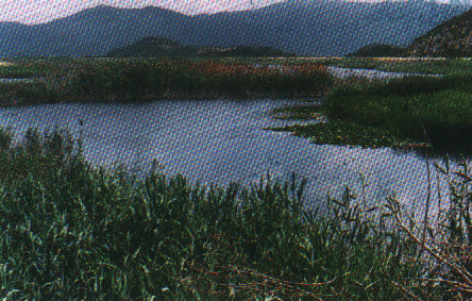
The project assessed environmental impacts from an irrigation scheme in Kato Evrotas, Peloponnese, addressing agrochemical use, river water quality, and proposing protection for the Asteriou biotope
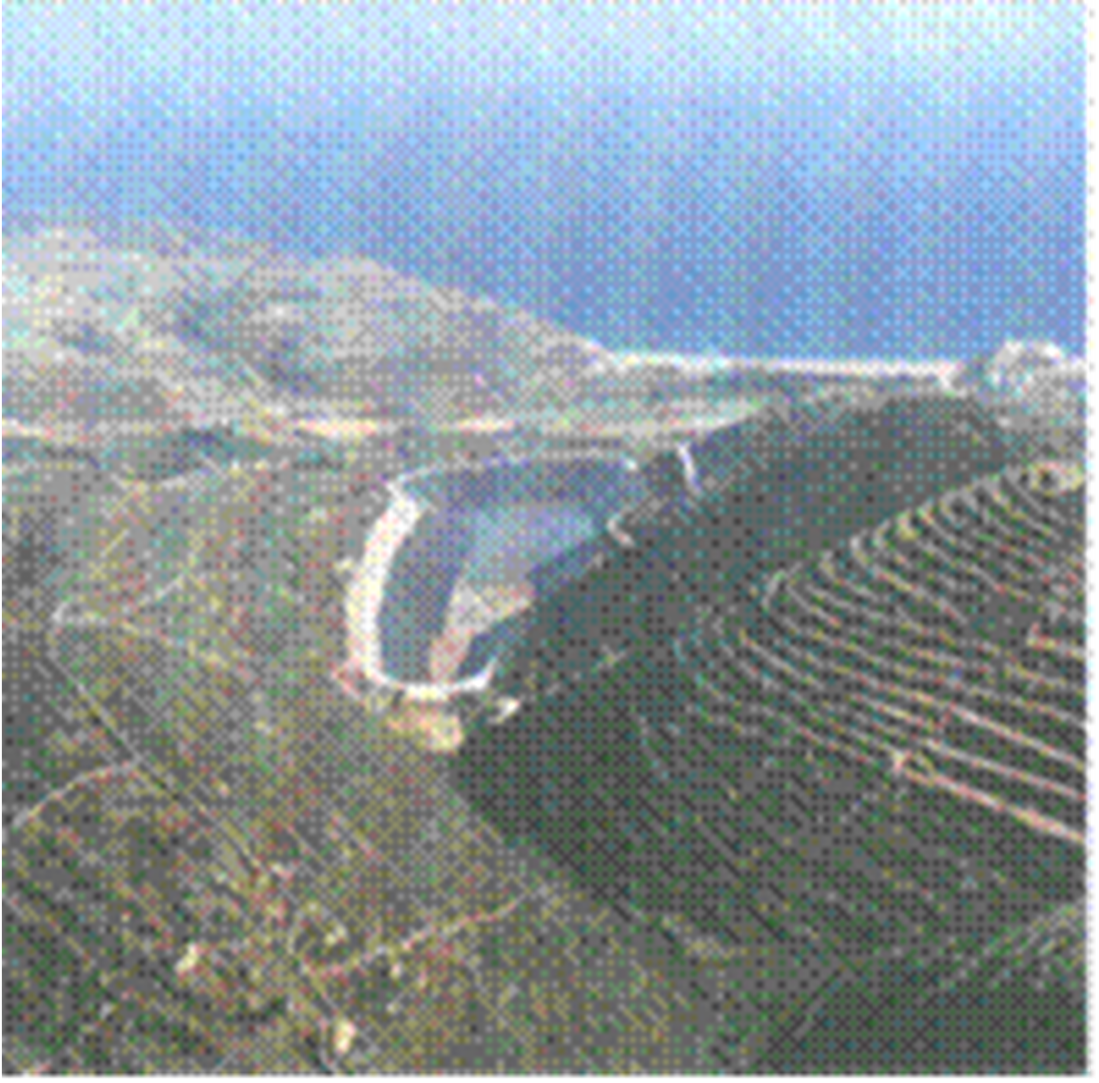
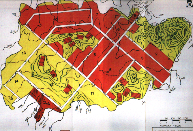
The project involved the design of the Eggares Reservoir in Naxos, exploiting surface water runoff in Cycladic watersheds for irrigation and water supply under semi-arid and high-tourism conditions.
The project involved the Environmental Impact Assessment for a 97ha industrial zone near Rhodes city, targeting the relocation of industries, mitigation of pollution, and economic development of the prefecture.
The project involved an Environmental Impact Assessment for the 70ha Industrial Area in southeastern Aigio, aiming to relocate existing industrial units, protect residential areas, and foster new industrial development.
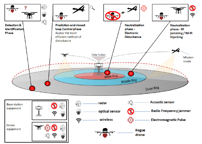
Proposed to deploy a multi-tier cybersecurity and threat-detection platform for protecting water infrastructure using IoT, UAV/USV surveillance, and AI analytics. Covered early-warning, anomaly detection, physical intrusion prevention, and cyberattack countermeasures.

Proposed to develop an open-access web platform for maritime safety, modeled after SKYbrary (aviation). Included human performance modeling, risk-based operational design, incident databases, training optimization tools, and modular safety innovation toolkits.
Proposed to establish a large-scale biodiversity observation and simulation framework across EU sea basins. Included sensor networks, spatial prioritization for conservation, data integration from EO platforms, and modeling of biodiversity shifts due to human and climate pressures.

Proposed to deliver a modular geo-referenced cloud platform (HPlus) for climate risk analysis, remediation, and lifecycle-based decision-making on cultural heritage sites. Included visualization tools, pilot sites, conservation guidelines, and an EEIG for long-term platform operation.