ENCs
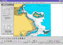
In partnership to LaserScan Ltd, UK, EPSILON produced for a private client and the Hellenic navy a demonstrator. The set of electronic navigation charts followed the ECDIS/S57 standards.
In partnership to LaserScan Ltd, UK, EPSILON produced for a private client and the Hellenic navy a demonstrator. The set of electronic navigation charts followed the ECDIS/S57 standards.

The aim of this European Commission funded project is to integrate a large amount of environmental data provided by the National/Regional Environmental Agencies and other public and private environmental stakeholders involved.

The aim of c-Space is to leverage on people familiarity with Augmented Reality (AR) software for tablets/smart phones and on emerging micro-projection technology to unleash users’ inventiveness.

The aim of the project is to promote convergent conservation strategies at landscape scale for coastal habitats of Community significance.
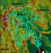
The project is funded by the Hellenic Foreign Office and delivers a sustainability & action plan for the entire river basin and the cataloguing of data and information stored into a publicly available website.

The EPSILON-CICADE joint venture bases its operations on the production of mapping data, from the aerial photographs to the processing and provision of that data.

DIGITAL-SEE aims at sharing spatial digital information across South East Europe, in three phases feasibility, technology implementation and pilots commercial operation.
The project creates a fully integrated water system which ties together all parts of the network, including the geographic information system (GIS), water leakage management system, pumping station control systems and the SCADA systems at each service branch. EPSILON is supplying a 5-years training and a 3-year preventative maintenance.
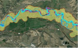
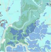
The project aimed at an integrated river management dealing with hydrologic and environmental engineering studies related to the storm drainage of the National Railway of Greece.
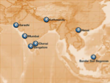
The ASIA_CITY project supplies a platform for the local-regional tourism authorities in Asia aimed to develop-enhance their tourism plans by pre-senting a commonly accepted plan -a Joint Strategy- in the IST technology field of “on-line navigational city information”.