HYBESS
INTEGRATED HYBRID-ENERGY STORAGE SYSTEMS FOR WATERBORNE APPLICATIONS
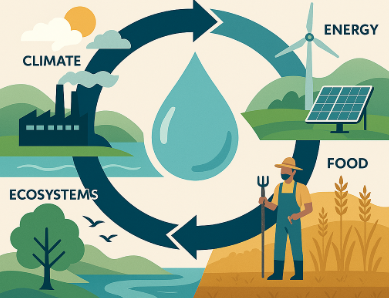
Proposed to operationalize the water–energy–food–ecosystem nexus in EU and regional policies. Delivered the WATNex Suite of tools, stakeholder engagement strategy, and policy integration pathways to support SDGs, climate resilience, and nexus-aligned decision-making.
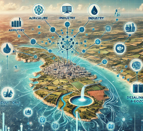
Proposed to assess long-term sectoral water demand in Malta under the LIFE-IP initiative. Delivered econometric modeling forecasts for domestic, agricultural, industrial, and tourism sectors, integrated with ArcGIS for planning and scenario analysis over a 50-year horizon.
WATER DEMAND MALTA Read More »
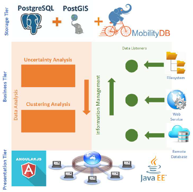
Proposed to build a PostgreSQL/PostGIS-based platform for mapping and analyzing vessel density in European waters. Aimed to support EU Green Deal objectives via digital density maps, marine data integration, and a user-friendly web GIS interface with open-source tools.
VTD – VESSEL TRAFFIC DENSITY Read More »

Proposed to design, build, and test a resilient offshore floating solar platform (FPV) for harsh oceanic environments. Delivered TRL6 prototypes, structural testing, circular materials evaluation, and commercialization strategy aligned with EU ocean energy objectives.
Proposed to implement a national-level training program in GIS and remote sensing for 140 public servants across Maltese agencies. Included modular certification (MQF 4.1 and 5.1), practical skills, and evidence-based planning support for Malta’s land administration and spatial governance.
Proposed to create a unified spatial data infrastructure across over 40 Maltese government entities. Delivered an ArcGIS-based interoperable portal, enhanced policymaking through geospatial integration, and provided user training for public sector administrators.
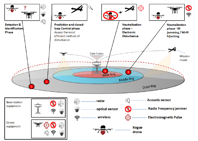
Proposed to deploy a multi-tier cybersecurity and threat-detection platform for protecting water infrastructure using IoT, UAV/USV surveillance, and AI analytics. Covered early-warning, anomaly detection, physical intrusion prevention, and cyberattack countermeasures.
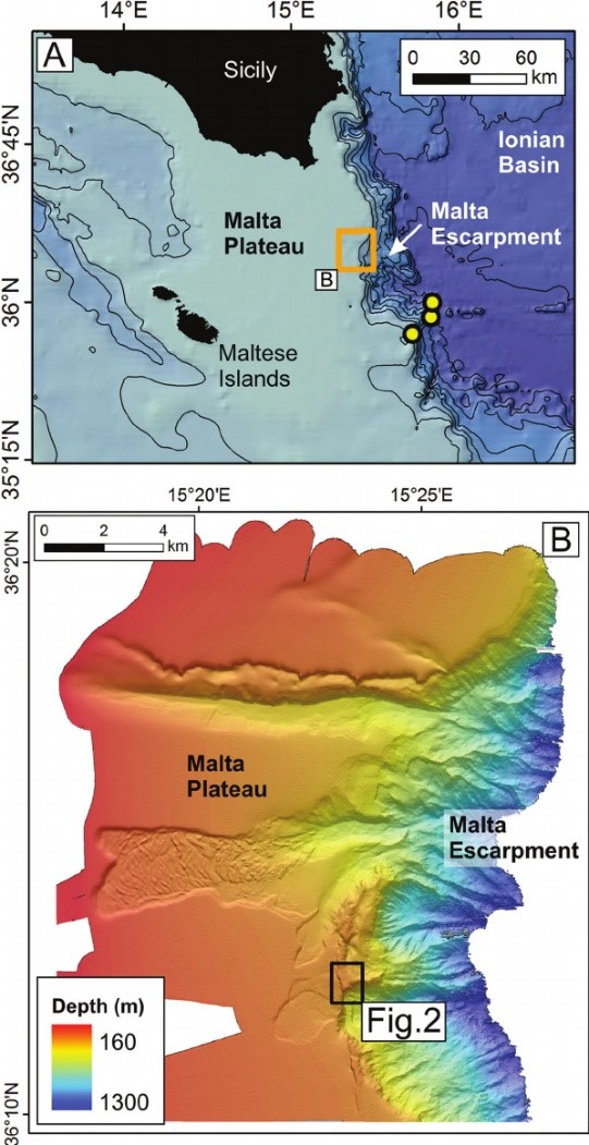
Proposed to deliver high-resolution multibeam mapping and bottom characterization in five marine zones around Malta. Included sediment sampling, geophysical interpretation, and digital seafloor maps to support national marine spatial planning and conservation actions.
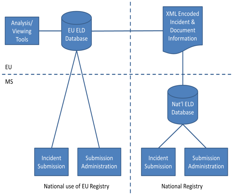
Proposed to support Phase 1 of the REFIT actions for the Environmental Liability Directive. Delivered registry design, legal analysis, harmonized definitions, stakeholder engagement, and capacity-building tools under DG Environment framework contract ENV.D.4.