ArcGIS technology to produce three-dimensional Aerodrome Navigational Databases for the General Aviation, and a database with 2000+ 3D-visualized EU aerodromes
Earth observation technology (Sentinel-4/5) to monitor the atmospheric ozone profile with unprecedented accuracy with multiple applications, incl. UV skin-heath impacts

Proposed to create an intelligent logistics platform using Digital Twins, AI, and blockchain to optimize multimodal supply chains. Targeted zero-emission logistics and synchronized transport operations through real-time simulation and stakeholder integration across European corridors.
Proposed to support border surveillance using Copernicus SAR data to detect high-speed “go-fast” smuggling boats. Combined Sentinel-1 data analysis, ship wake detection, and AIS fusion for activity pattern analysis in Mediterranean sea corridors.
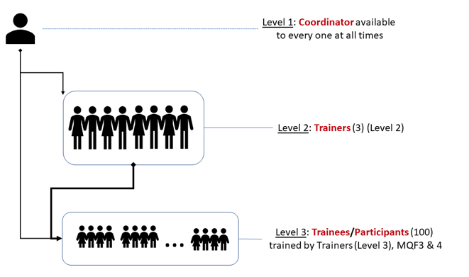
Proposed to train 140 public servants in Malta on GIS and remote sensing. Delivered modular courses (basic and advanced), skill assessments, and digital resources to improve spatial planning capacity and compliance with EU data directives (e.g. INSPIRE, Aarhus).
New Generation of a recoverable low-cost micro-UAV platform for wildfires, structurally robust to fly through the fire and acquire/forward real-time info for fire management

LANDING delivers a low-cost software product (SW) assisting pilots of small-medium aircrafts to safely land on a small and poorly equipped fields, under bad-weather and low-visibility conditions.
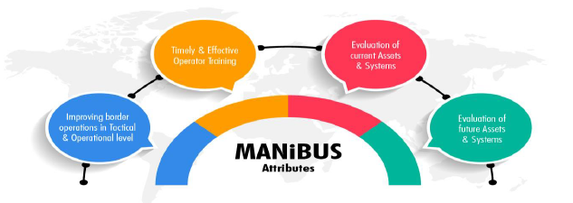
Proposed to design a 4D digital twin system for land and maritime border surveillance. Delivered interoperable platforms, training tools, XR interfaces, decision-support modules, and real-time integration of heterogeneous data for improved EU external security.

Proposed to develop a hybrid autonomous underwater system combining AUV and glider technologies. Delivered enhanced energy efficiency, secure data transmission, deep-sea mapping capabilities, and operational autonomy with low-cost deployment systems.
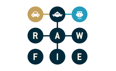
The purpose of the RAWFIE initiative is to create a federation of different network testbeds that will work together to make their resources available under a common framework.
Creation of a cohesive spatial data infrastructure (SDI) for all Maltese entities, ensuring standardized interoperability of 70+ interconnected Geomatics systems
Proposed to create a unified spatial data infrastructure across over 40 Maltese government entities. Delivered an ArcGIS-based interoperable portal, enhanced policymaking through geospatial integration, and provided user training for public sector administrators.
Proposed to implement a national-level training program in GIS and remote sensing for 140 public servants across Maltese agencies. Included modular certification (MQF 4.1 and 5.1), practical skills, and evidence-based planning support for Malta’s land administration and spatial governance.